Krafla is considered to be the clock generator and curator of the Myvatn region. The active volcanic system characterises the rugged north-east of Iceland like no other and provides bizarre and multi-faceted landscape formations.
Solfatar field Namafjall, the “dark castles” Dimmuborgir, tuff ring Hverfjall, Grjotagja Grotto and even an own geothermal power station: If you would like to describe the scenic influence of Krafla on the Myvatn region with just one word, rich in contrast would probably be the right term.
Myvatn Region: Landscape diversity
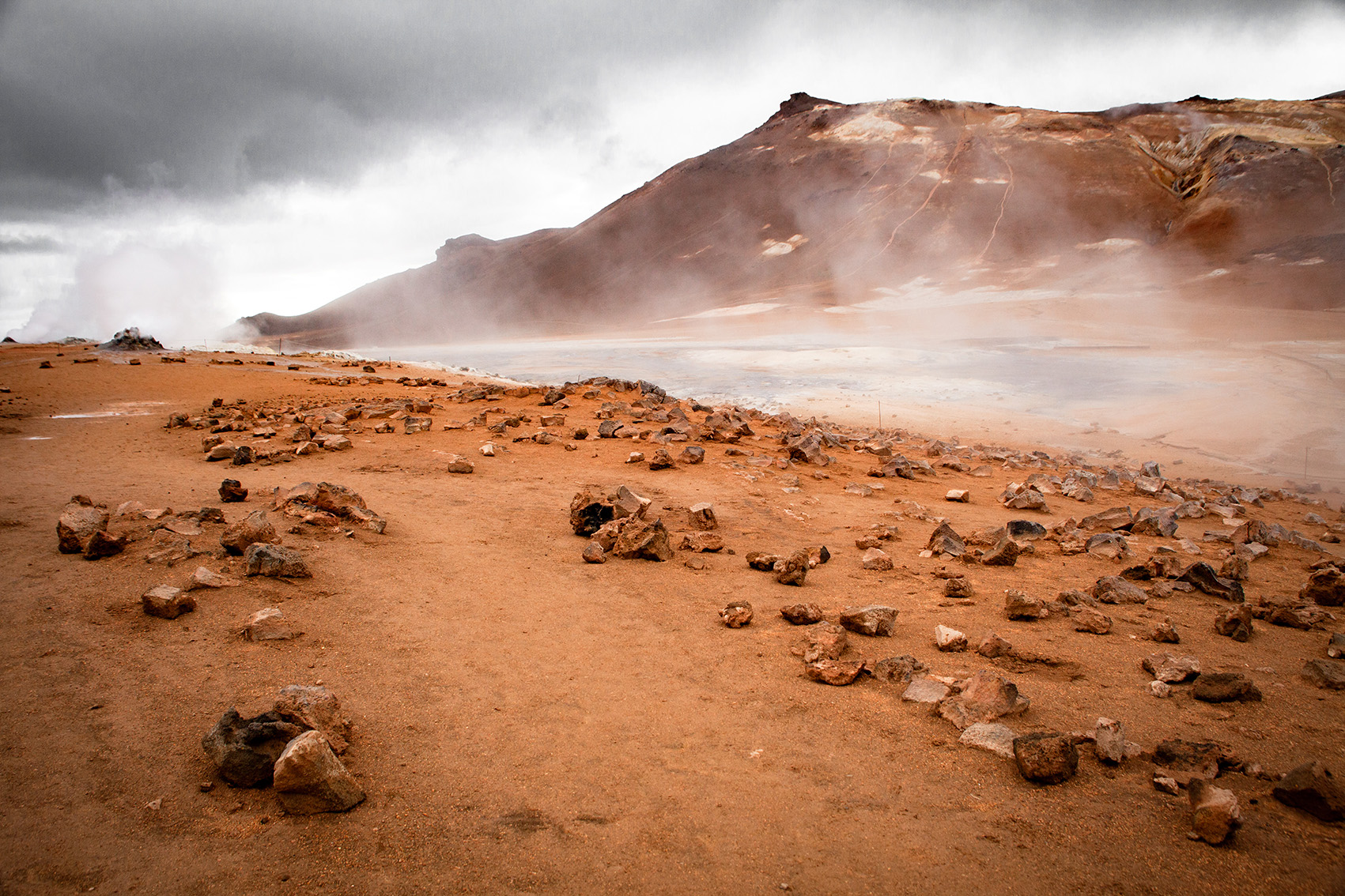
It is precisely this contrast, that makes the region so fascinating. Tuff ring Hverfjall, for example, looks like the gloomy backdrop of a Hollywood-ready end-time scenario. Dimmuborgir, on the other hand, abducts the fantasy into a fairytale world. At the geothermal area Namafjall Hverir the ground bubbles. At Krafla geothermal power station, gigantic columns of steam rise up.
-
vulcano-krafla
Iceland, Myvatn, Myvatn Region, Sightseeing, Adventure, Travel, Photography, Hverarönd, Geothermal area, Solfatar Field, Travel
-
volcano-krafla
Iceland, Myvatn, Myvatn region, nature phenomenon, sightseeing, adventure, travel, volcano, volcanic activity, photography, adventure, fault zone
-
volcano-krafla
Iceland, Myvatn, Myvatn Region, Grotto, Lake, Hot spring, Geothermal energy, Geothermal area, Energy, Geothermal energy, Nature phenomenon, Sightseeing, Adventure, Travel, Travel, Photography
-
volcanio-krafla
Iceland, Myvatn, Myvatn region, tuffring, water vapour explosion, nature phenomenon, sightseeing, adventure, travel, travel, volcano, photography
-
volcano-krafla
Iceland, Myvatn, Myvatn region, nature phenomenon, sightseeing, adventure, travel, volcano, volcanic activity, photography, adventure, fault zone
-
volcano-krafla
Iceland, Myvatn, Myvatn region, nature phenomenon, sightseeing, adventure, travel, volcano, volcanic activity, photography, adventure, fault zone
-
volcano-krafla
Iceland, Myvatn, Myvatn region, power plant, geothermal power plant, geothermics, geothermal energy, energy, geothermal energy, water vapour, natural phenomenon, sightseeing, adventure, travel, travel, photography
-
volcano-krafla
Iceland, Myvatn, Myvatn region, nature phenomenon, sightseeing, adventure, travel, volcano, volcanic activity, photography, adventure, fault zone
-
namafjall-hverir
Iceland, Namafjall Hverir, Hverarönd, Myvatn, Myvatn Region, Geothermal area, solfatars field, nature phenomenon, sightseeing, adventure, travel, travel photography
-
volcano-krafla
Iceland, Myvatn, Myvatn region, nature phenomenon, sightseeing, adventure, travel, volcano, volcanic activity, photography, adventure, fault zone
-
volcano-krafla
Iceland, Myvatn, Myvatn region, nature phenomenon, sightseeing, adventure, travel, volcano, volcanic activity, photography, adventure, fault zone
-
volcano-krafla
Iceland, Myvatn, Myvatn region, power plant, geothermal power plant, geothermics, geothermal energy, energy, geothermal energy, water vapour, natural phenomenon, sightseeing, adventure, travel, travel, photography
-
volcano-krafla
Iceland, Myvatn, Myvatn region, nature phenomenon, sightseeing, adventure, travel, volcano, volcanic activity, photography, adventure, fault zone
-
volcano-krafa
Iceland, Myvatn, Myvatn region, nature phenomenon, sightseeing, adventure, travel, volcano, volcanic activity, photography, adventure, fault zone
-
volcano-krafla
Iceland, Myvatn, Myvatn region, nature phenomenon, sightseeing, adventure, travel, volcano, volcanic activity, photography, adventure, fault zone
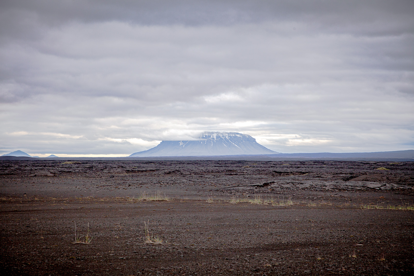
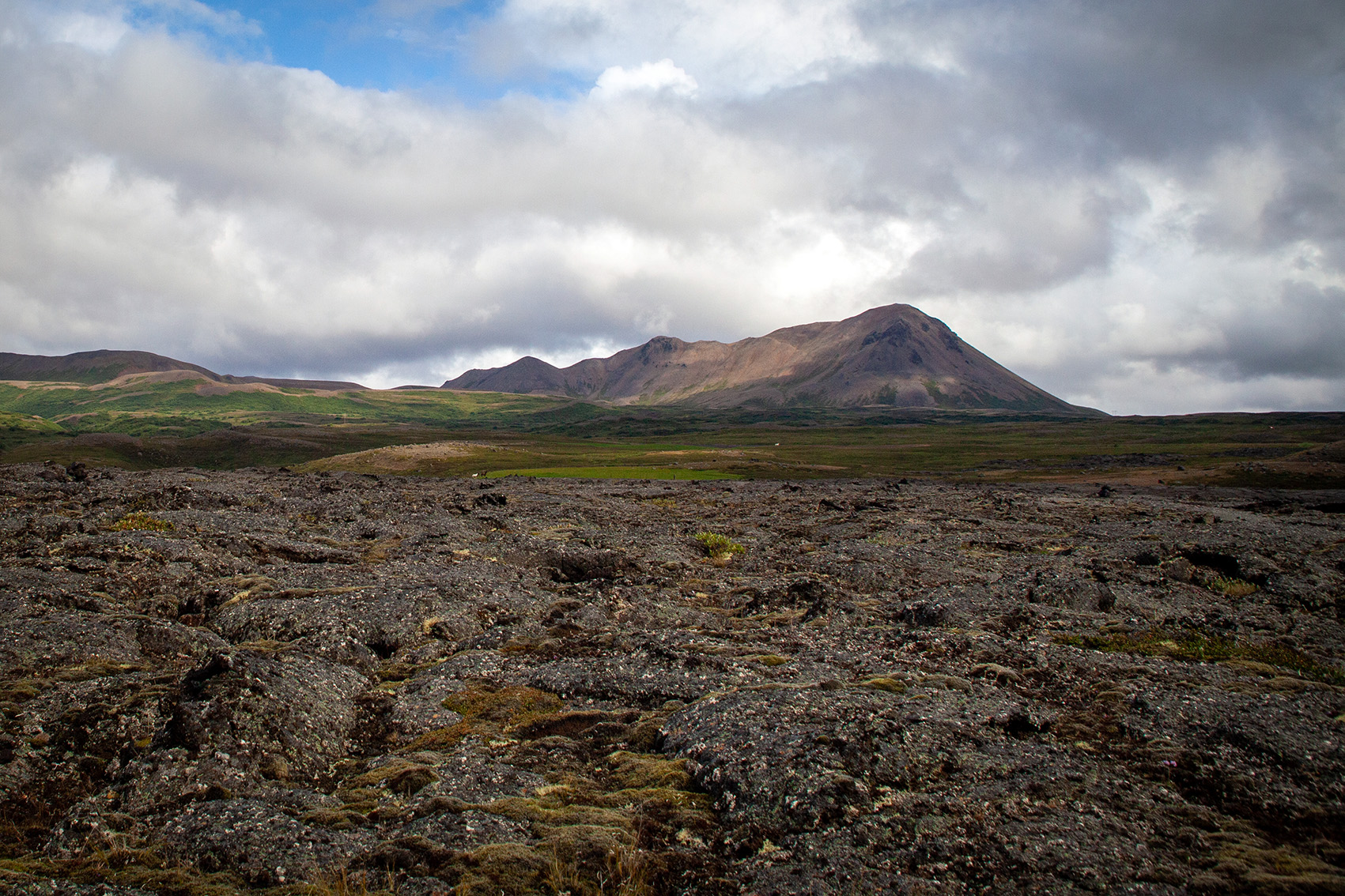
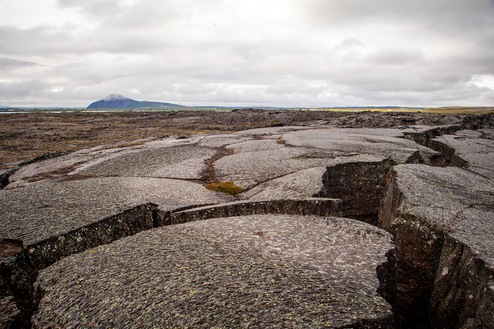
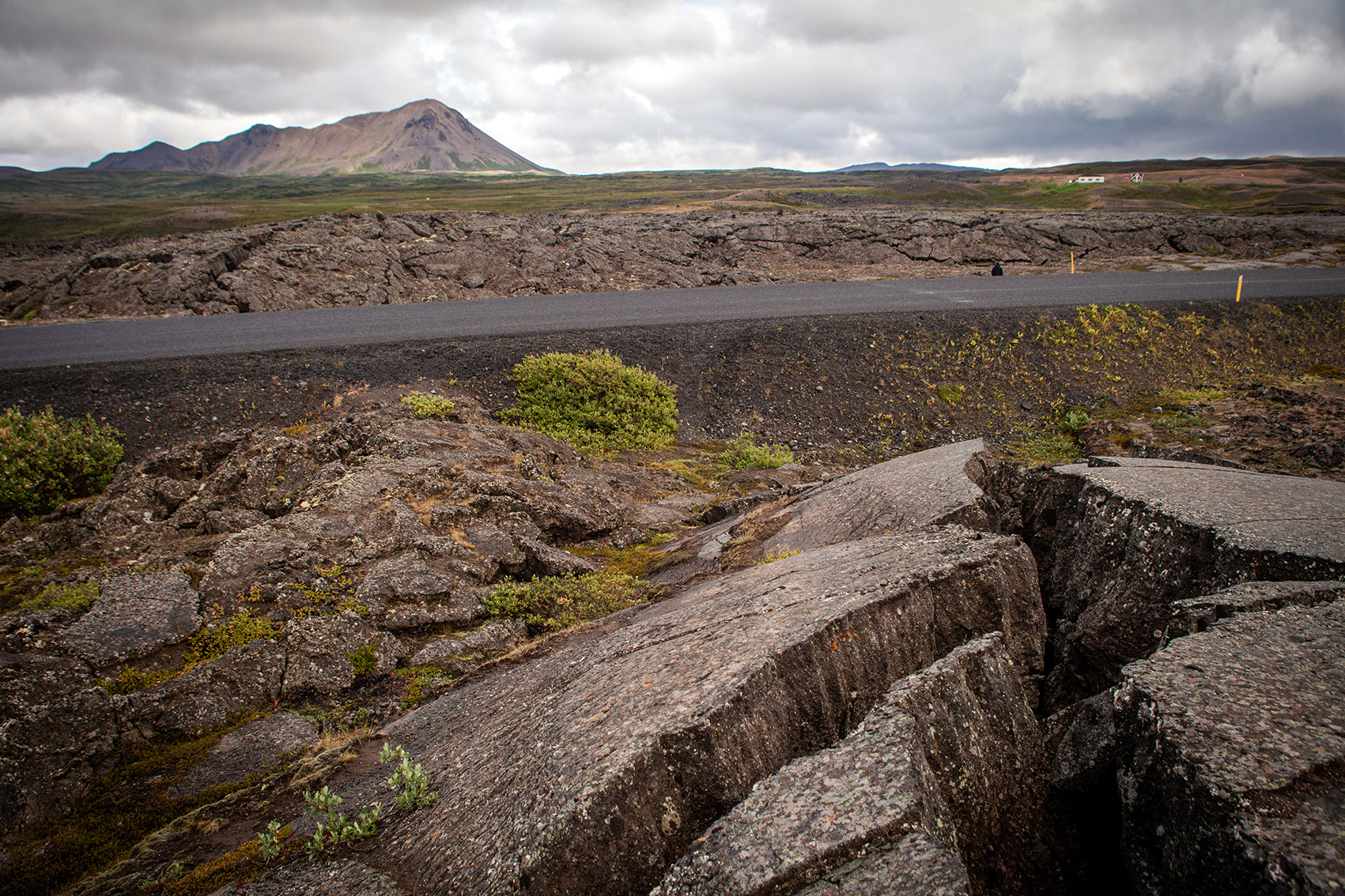
Drifting continental plates release gigantic forces
Like no other, Krafla dominates the face of Iceland’s northeast. Various eruption phases have brought about constant change over thousands of years. The reason for this lies deep inside the earth. It runs for over 100 kilometres along the Mid-Atlantic Ridge. This is where the North American and Eurasian continental plates drift a good two centimetres apart every year.
Active magma chamber provides dynamics
Geologically, Krafla is still a young boy. It is only 200,000 years old. The last large eruption phases took place between 1724 and 1729 (Myvatn Fire) and from 1975 to 1984 (Krafla Fire). Today it still has an active magma chamber. This chamber is located about three kilometres below the volcanic system. Its dynamics act as a motor and pioneer for tectonic peculiarities in the region.
-
volcano-krafla
Iceland, Myvatn, Myvatn region, nature phenomenon, sightseeing, adventure, travel, volcano, volcanic activity, photography, adventure, fault zone
-
volcano-krafla
Iceland, Myvatn, Myvatn region, tuffring, water vapour explosion, nature phenomenon, sightseeing, adventure, travel, travel, volcano, photography
-
volcano-krafla
Iceland, Myvatn, Myvatn region, tuffring, water vapour explosion, nature phenomenon, sightseeing, adventure, travel, travel, volcano, photography
-
volcano-krafla
Iceland, Myvatn, Myvatn region, tuffring, water vapour explosion, nature phenomenon, sightseeing, adventure, travel, travel, volcano, photography
-
volcanio-krafla
Iceland, Myvatn, Myvatn region, tuffring, water vapour explosion, nature phenomenon, sightseeing, adventure, travel, travel, volcano, photography
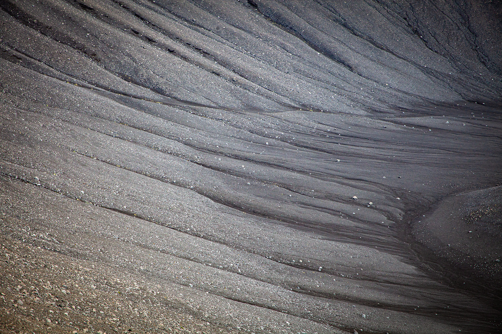
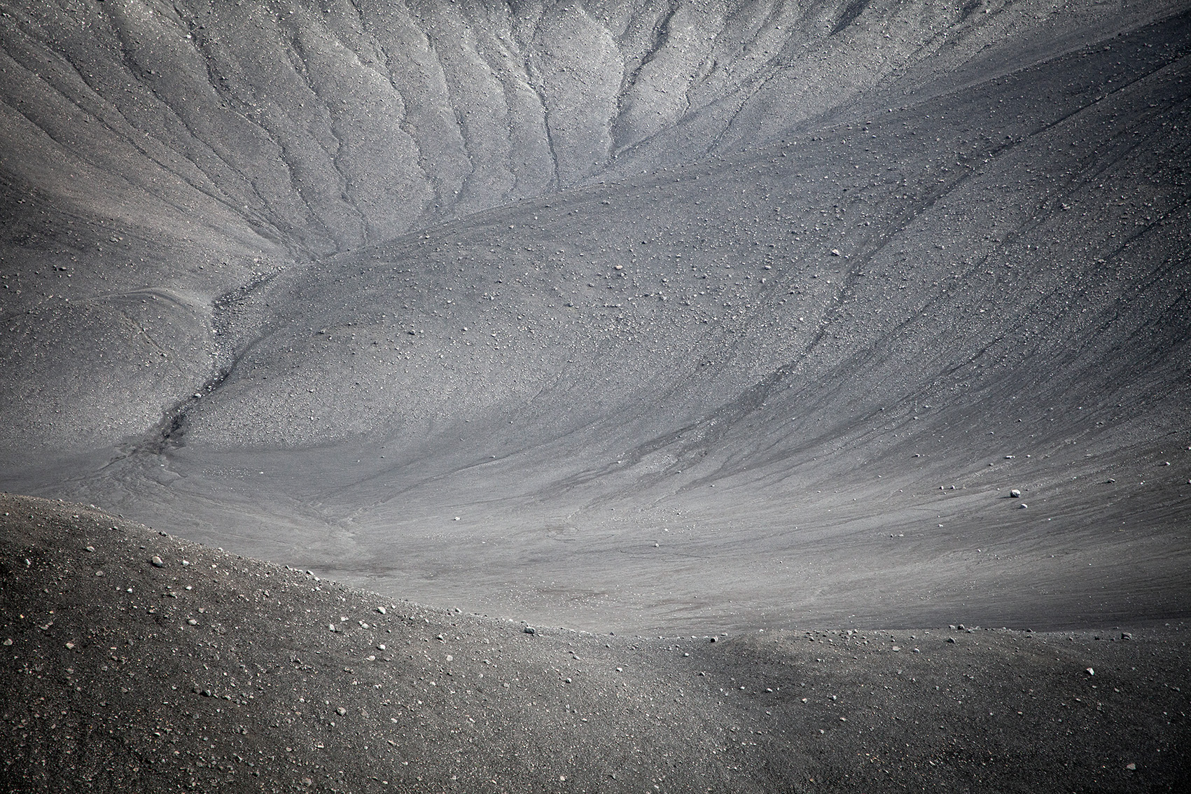
Tuff ring Hverfjall: Result of a Water vapour explosion
One of these very worth seeing peculiarities is the 452 meter high tuff ring Hverfjall. It was formed around 2,500 years ago as the result of a huge water vapour explosion. At that time, hot magma encountered groundwater. The force of the explosion hurled around 250 million cubic metres of rock material through the air. Trickling debris and ash formed the explosion crater, which looks like a volcanic vent.
-
volcano-krafla
Iceland, Myvatn, Myvatn region, lava field, rock formations, film set, nature phenomenon, sightseeing, adventure, travel, travel, photography, Dimmuborgir
-
volcano-krafla
Iceland, Myvatn, Myvatn region, lava field, rock formations, film set, nature phenomenon, sightseeing, adventure, travel, travel, photography, Dimmuborgir
-
volcano-krafla
Iceland, Myvatn, Myvatn region, lava field, rock formations, film set, nature phenomenon, sightseeing, adventure, travel, travel, photography, Dimmuborgir
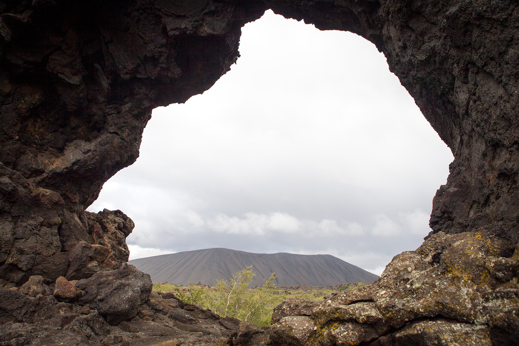
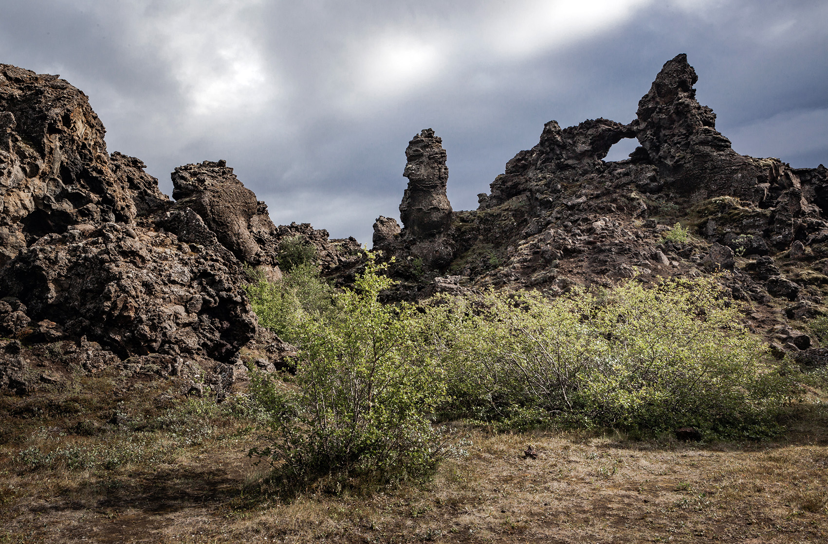
Dimmuborgir: dark castle ruins of rugged rock
Literally fantastic insights into Icelandic mythology can be found in Dimmuborgir, a somewhat more southerly, cooled lava field. Elves, trolls and other hidden creatures should live there in the rugged rock formations. At least that’s what the Icelanders believe. Tectonically, the rugged rock formations are the remains of a collapsed lava lake. Their bizarre appearance is reminiscent of enchanted castle ruins. This is probably one of the reasons why the place recently served as the backdrop for the successful fantasy series “Game of Thrones”.
-
volcano-krafla
Iceland, Myvatn, Myvatn Region, Grotto, Lake, Hot spring, Geothermal energy, Geothermal area, Energy, Geothermal energy, Nature phenomenon, Sightseeing, Adventure, Travel, Travel, Photography
-
volcano-krafla
Iceland, Myvatn, Myvatn region, geothermal energy, geothermal region, energy, geothermal energy, natural phenomenon, sightseeing, adventure, travel, travel, photography, fault zone
-
volcano-krafla
Iceland, Myvatn, Myvatn region, geothermal energy, geothermal region, energy, geothermal energy, natural phenomenon, sightseeing, adventure, travel, travel, photography, fault zone
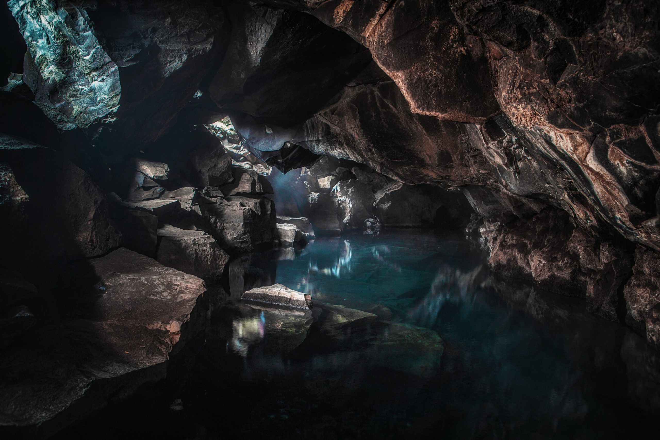
Grjotagja: Mystic grotto in a lava field
Between Hverfjall and the solfatar field Namafjall (Hverarönd) nature once again shows what graceful artworks it can create. The view of the Grjotagja grotto is magical. All in all almost unreally beautiful. Geologically, it lies directly on the fault zone between American and Eurasian continental plate. This fault can already be seen from the outside as a fissured crack in the ground. Those who find their way to the entrance to the grotto, suddenly they find themselves in front of a shimmering blue underground lake. Volcanic activity heats the water to around 45 degrees. The grotto used to be a popular seaside resort for locals and tourists. Today bathing fun is – at least officially – forbidden due to the high germ load in the water.
-
volcano-krafla
Iceland, Myvatn, Myvatn region, power plant, geothermal power plant, geothermics, geothermal energy, energy, geothermal energy, water vapour, natural phenomenon, sightseeing, adventure, travel, travel, photography
-
volcano-krafla
Iceland, Myvatn, Myvatn region, power plant, geothermal power plant, geothermics, geothermal energy, energy, geothermal energy, water vapour, natural phenomenon, sightseeing, adventure, travel, travel, photography
-
volcano-krafla
Iceland, Myvatn, Myvatn region, power plant, geothermal power plant, geothermics, geothermal energy, energy, geothermal energy, water vapour, natural phenomenon, sightseeing, adventure, travel, travel, photography
-
volcano-krafla
Iceland, Myvatn, Myvatn region, power plant, geothermal power plant, geothermics, geothermal energy, energy, geothermal energy, water vapour, natural phenomenon, sightseeing, adventure, travel, travel, photography
-
volcanic-krafla
Iceland, Myvatn, Myvatn region, power plant, geothermal power plant, geothermics, geothermal energy, energy, geothermal energy, water vapour, natural phenomenon, sightseeing, adventure, travel, travel, photography
-
volcano-krafla
Iceland, Myvatn, Myvatn region, power plant, geothermal power plant, geothermics, geothermal energy, energy, geothermal energy, water vapour, natural phenomenon, sightseeing, adventure, travel, travel, photography
-
volcano-krafla
Iceland, Myvatn, Myvatn region, power plant, geothermal power plant, geothermics, geothermal energy, energy, geothermal energy, water vapour, natural phenomenon, sightseeing, adventure, travel, travel, photography
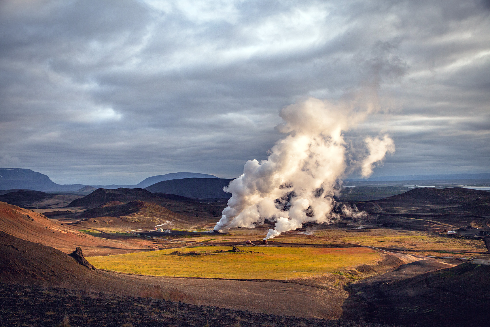
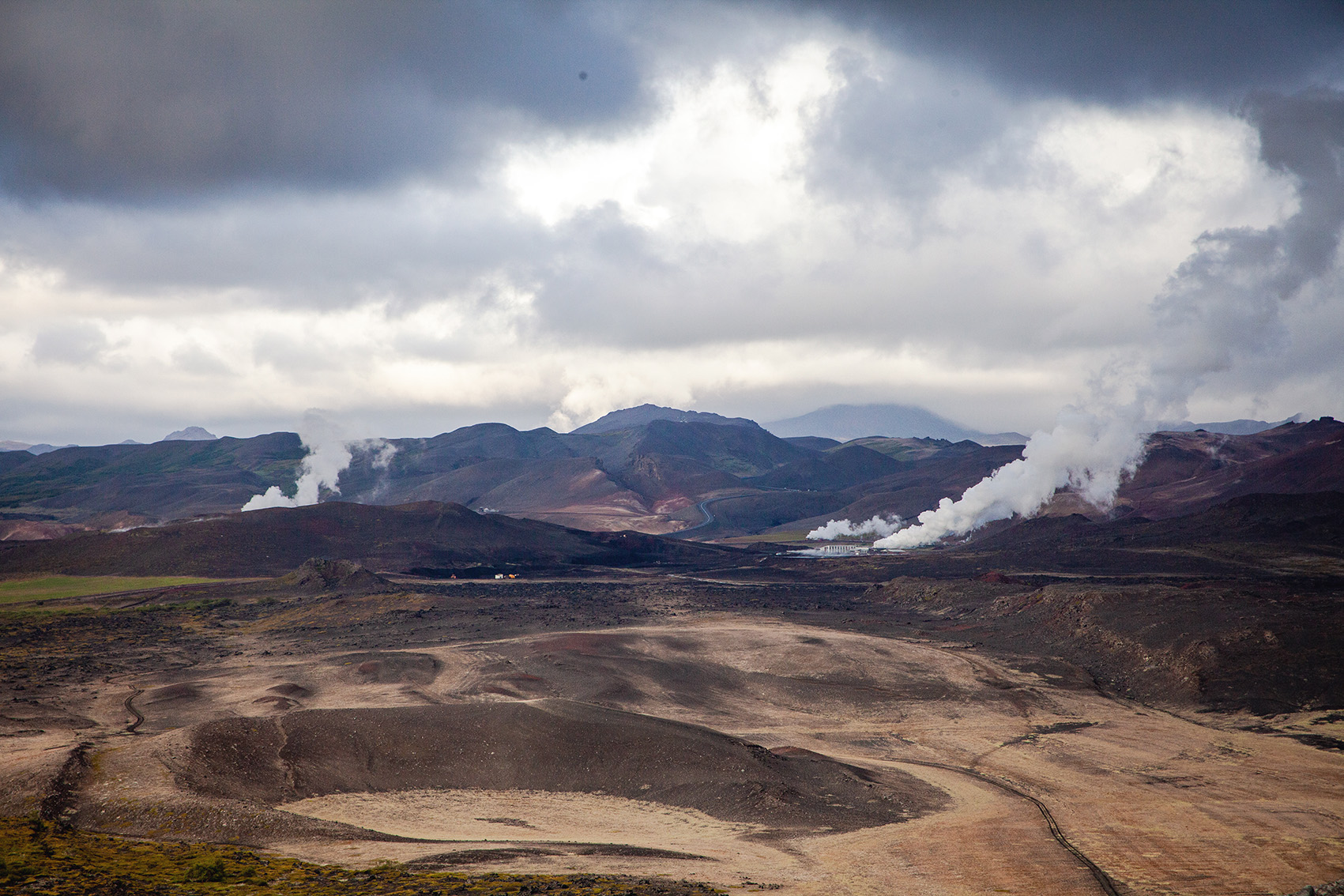
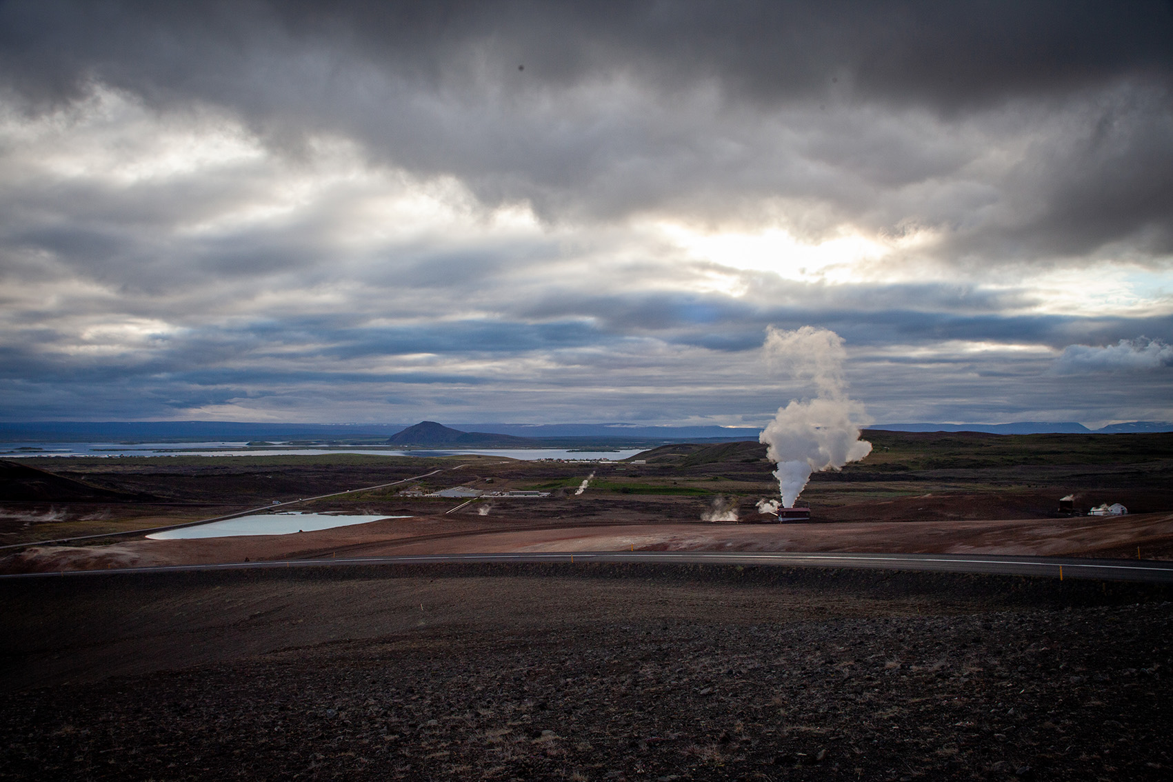
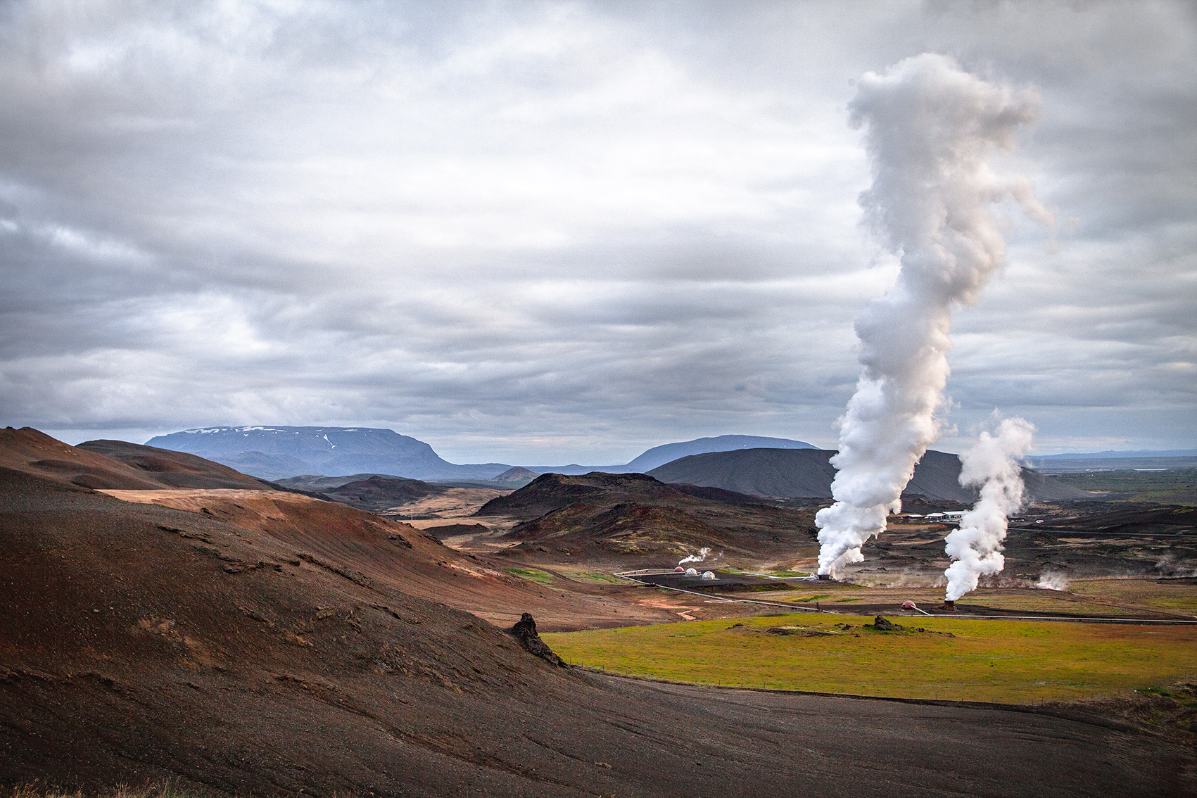
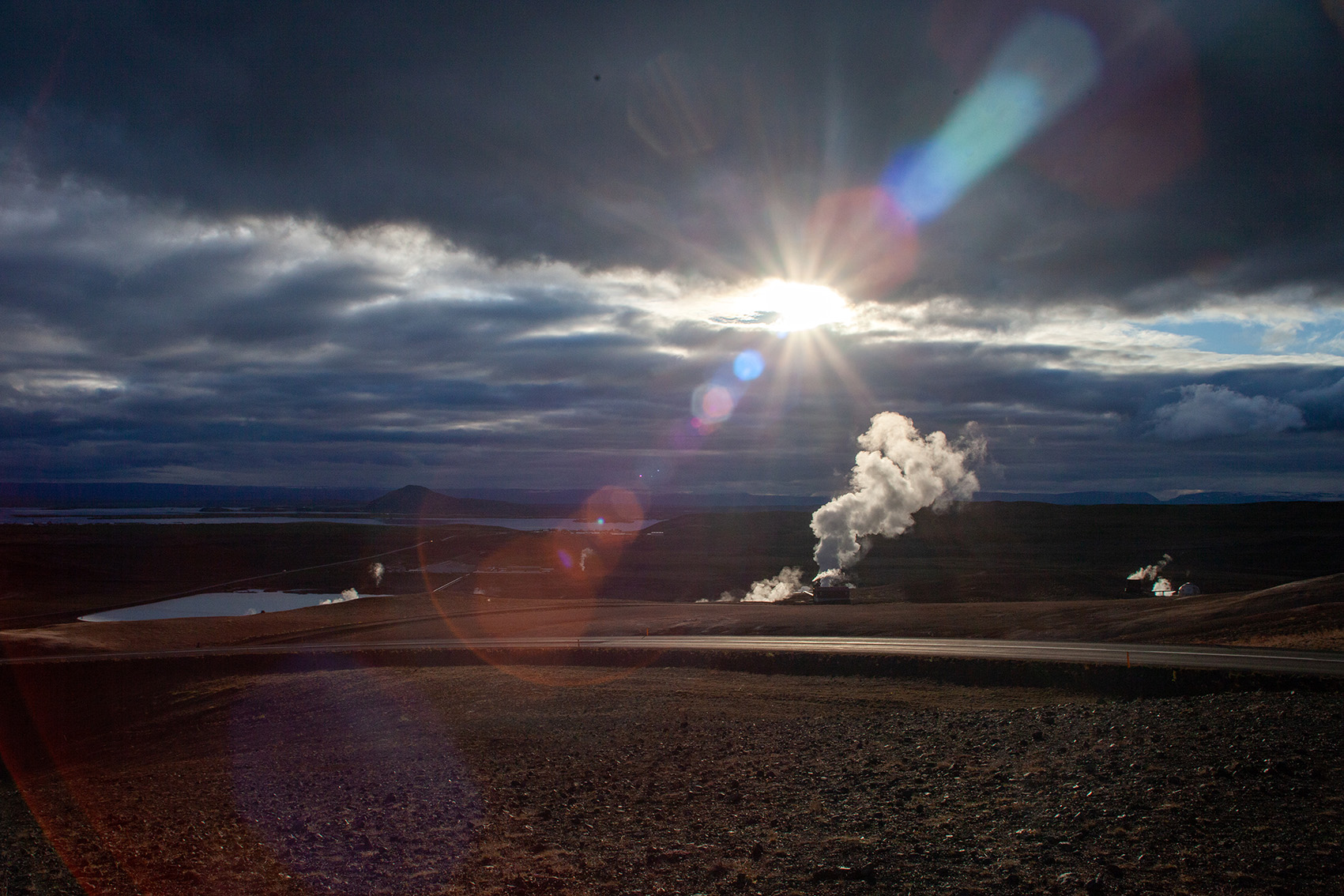
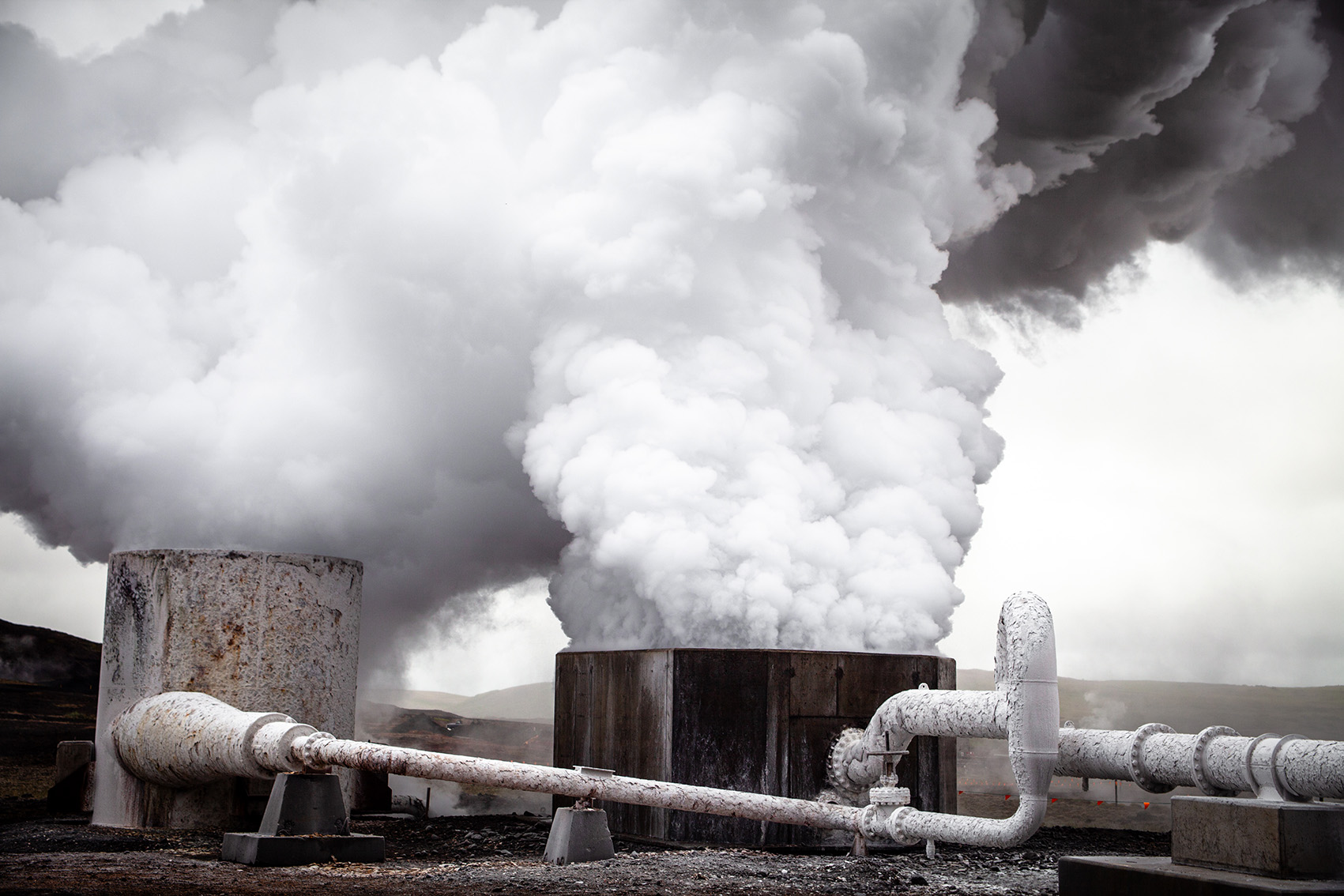
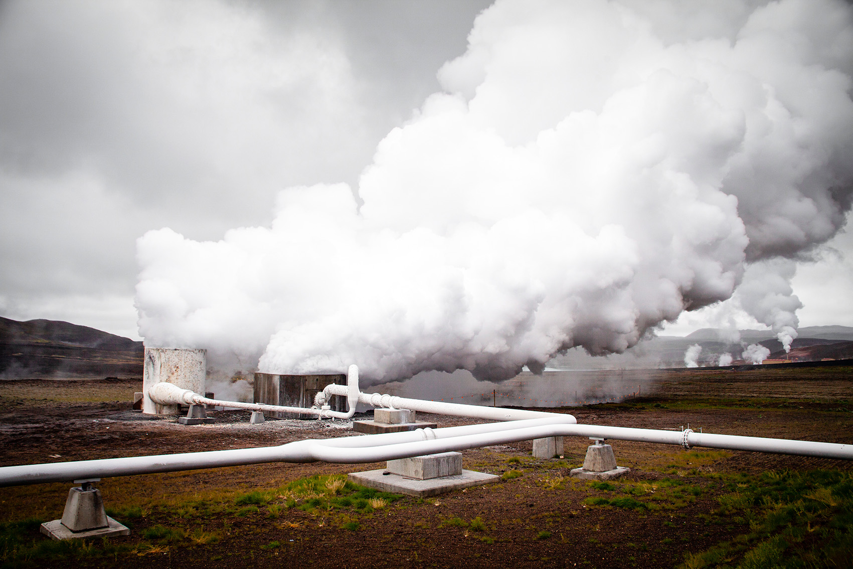
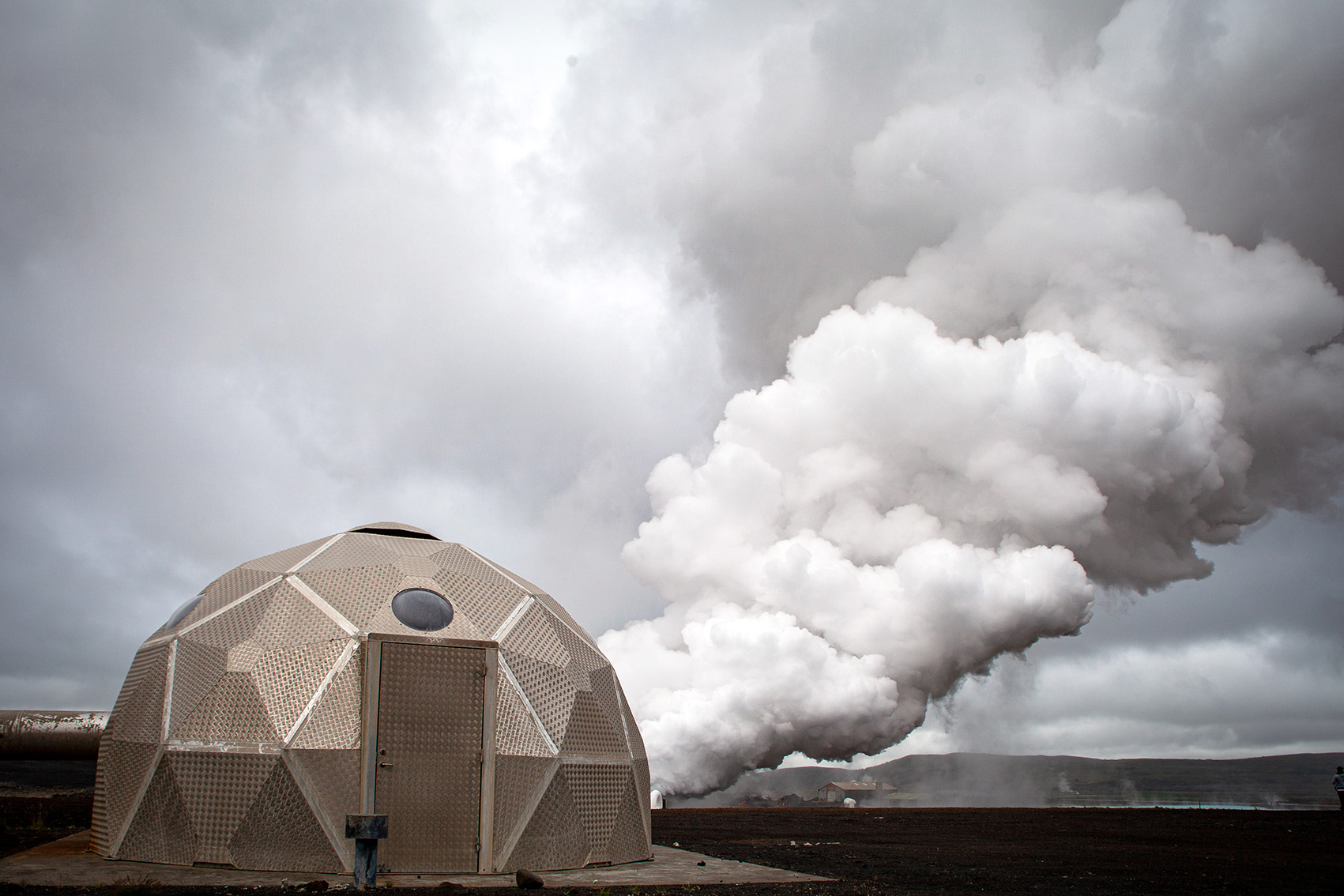
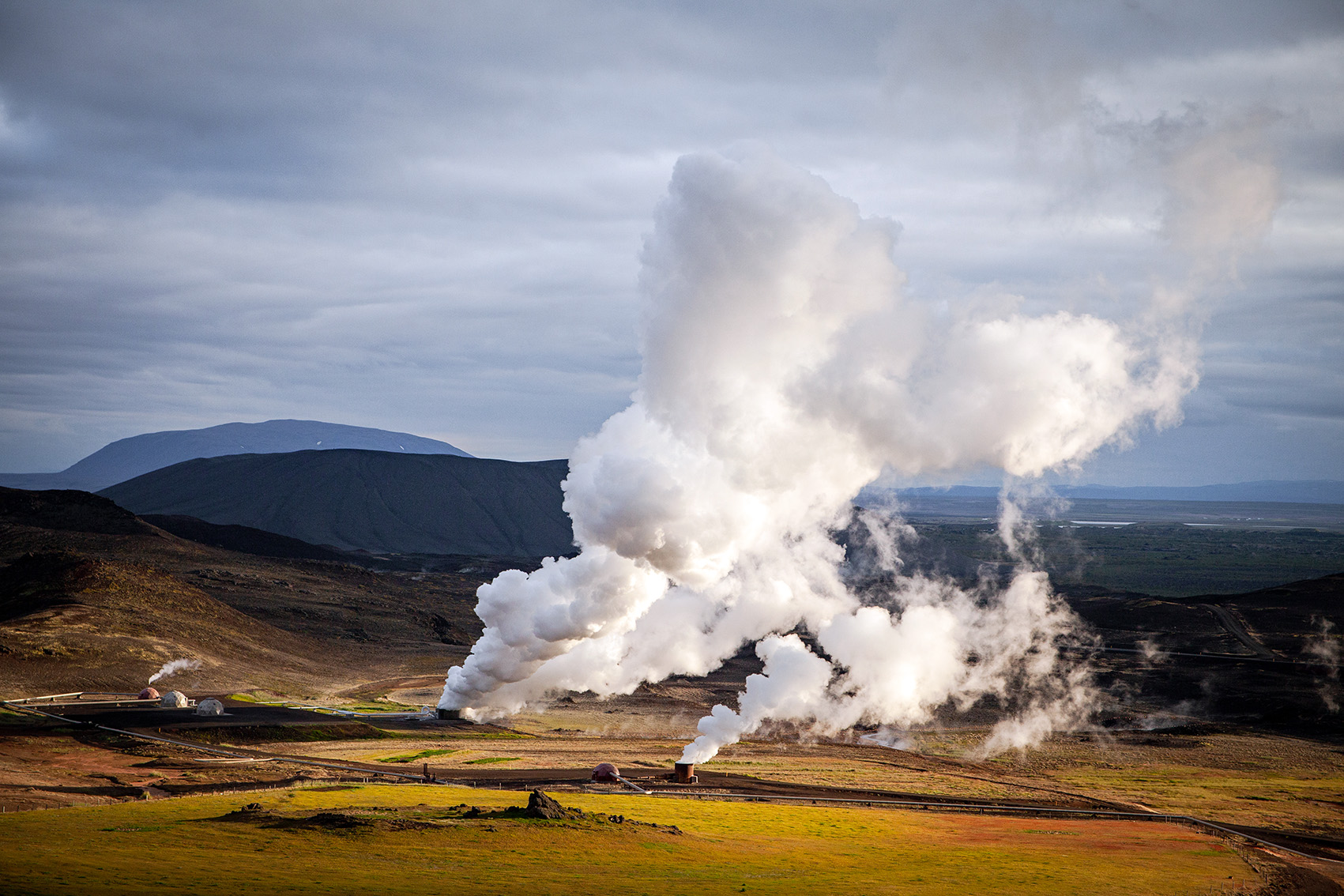
Geothermal power station Krafla: energy for free
The fact that volcanic forces are not only threatening, but also very useful is shown by the Krafla geothermal power plant. There, Icelanders defy their native forces of nature with stoic pragmatism and gain energy at no cost. They even built the geothermal power plant known as Kröfluvirkjun during two modern eruption phases – the Krafla Fire (1975 to 1984). Although the lava flows of the volcanic system flowed dangerously close to the power plant site, they tapped into its magma at a depth of around 2000 metres. The power plant was completed in 1999 and has since been supplying an energy output of around 60 megawatts.
Best travel time, directions, tours, hikes & accommodations
In Iceland’s northeast, summer is also very cool. Even in the warm months, average temperatures rarely climb above 15 degrees. Therefore, it is advisable to plan a trip from May to August. Then also the days are long bright, so that a lot of time is available for sightseeing. Due to the cool temperatures, one should also bring warm clothes for the summer months.
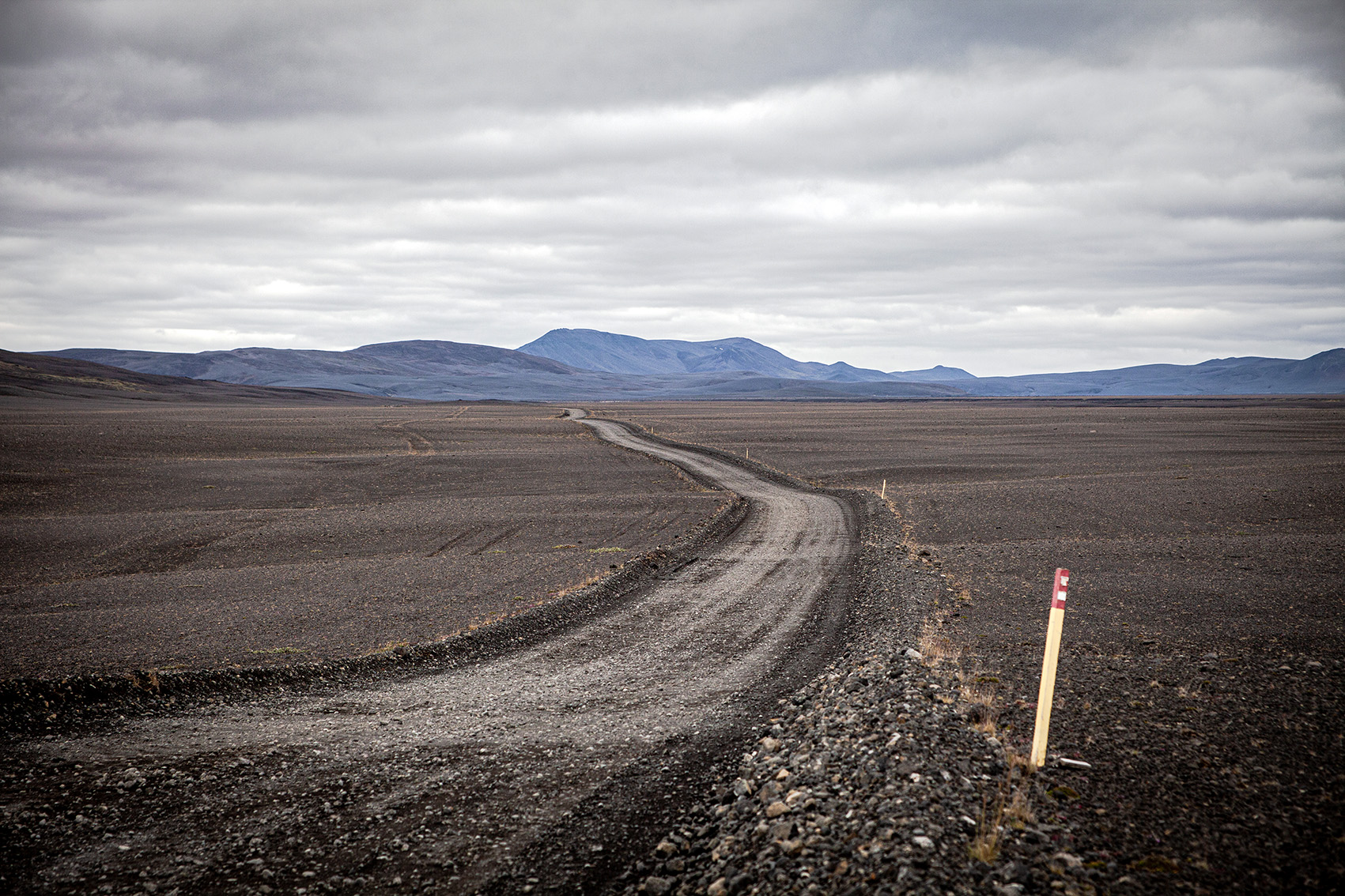
Myvatn region is about 90 kilometres east of Akureyri and can be reached by car in about an hour. The region’s point of contact is the small town of Reykjahild on the northern shore of Lake Myvatn. It can be reached via the ring road. From there, all sights can be visited in a relaxed way. They are all just a few kilometres from Reykjahild and can be reached by car in a maximum of 15 minutes. The region can also be easily explored on various hiking routes. A special highlight is the one kilometre long hike on the ring wall of Hverfjall.
In Myvatn region there are countless guesthouses and hotels in all price ranges. If you prefer camping, Vogar Camp Ground is a great place to stay overnight. With Daddi’s Pizza there is even a small pizzeria on the area. Nevertheless, camping is only recommended for the hard-boiled. The nights in the tent can be quite cool even in the summer months.
As the sights of the Myvatn region are very close to each other, you can explore them by rental car on your own. Two days are ideal. If you don’t stay too long in one place, you can even make all the highlights in one day. Alternatively, many tour operators offer guided tours from Akureyri or Reykjavik. The classic is a Diamond Circle Tour from Akureyri, although it does not visit all the sights described in this article. Those who want to visit the film locations of Game of Thrones in the Myvatn region will get their money’s worth at Saga Travel. From Reykjavik, excursions to the Myvatn region are offered as a three-day tour by minibus or as a day trip by small plane.
Camera tips: Motifs & Equipment
Myvatn region has a cornucopia of different photo motifs. From jagged rock formations and pattern structures in the sulphur fields to rising columns of steam and threatening crater scenarios. A wide-angle lens (15 – 28mm) should not be missing within the photographic equipment. For details of the surface structures a telephoto lens with a focal length of approx. 200mm is ideal.
The most beautiful shots are often taken at sunrise or sunset. Then the light is particularly soft and atmospheric. The Myvatn region is ideal for taking panoramas due to the vast size of the areas. If you want to capture moving objects, for example splashing mud pots or rising columns of steam, you can find out here, how this works. Another tip on the absorption of steam clouds: In backlighting, their structures come into their own particularly well.
Könnte Dich auch interessieren!
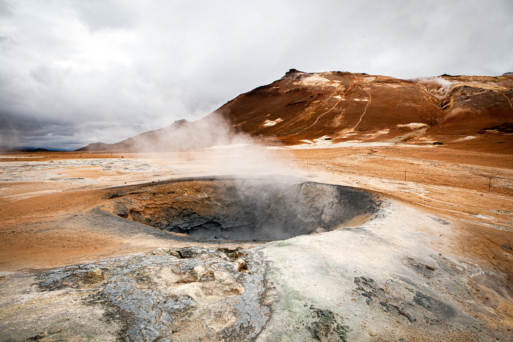
 Surreal: Geothermal area Namafjall Hverir
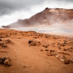
Just a stone's throw away from the tranquil Lake Myvatn, the door opens to a surreal world. In the Georhermal region of Namafjall Hverir, probably Iceland's most impressive solfatar field, volcanic activity is at hand.
 Iceland's icy pearl: Glacier lagoon Jökulsárlón
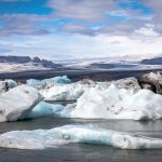
In the southeast of the island, Iceland hides it's crown jewels: The glacier lagoon Jökulsárlón and the nearby Diamond Beach. Its bright colours seem almost unreal and reveal the creative power of nature.
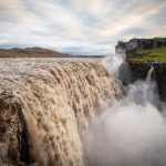 Dettifoss Waterfall: Iceland's powerful giant
In the north-east of the country Iceland's powerhouse rages: "The falling waterfall" or better known as Dettifoss. It is regarded as the most powerful waterfall in Europe. If you stand in front of it, you'll quickly see why!